Hidden Gems Along Dunrobin's Ottawa River Shoreline

Quick Tip
The best time to explore Dunrobin's Ottawa River shoreline is during weekday mornings when the boat launches are quiet and the water is glassy calm.
This post maps out the quietest, most rewarding spots along Dunrobin's stretch of the Ottawa River — places that don't show up on typical tourist maps. Whether you're after a peaceful morning paddle, a secluded picnic spot, or a shoreline walk without the crowds, these local finds deliver.
Where Can You Launch a Kayak Near Dunrobin Without the Crowds?
Most paddlers head to Kichi Sîbî Trail — and that's exactly why you shouldn't. The real launch points hide in plain sight along Dunrobin Road's lesser-known turnoffs.
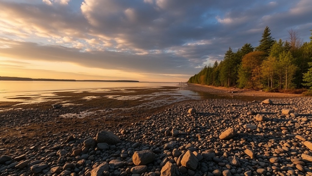
Constance Creek empties into the Ottawa River just west of the main village. Put in at the informal access point near Dunrobin Community School (the creek side, not the main road). You'll paddle through cattail channels before hitting open water — no motorboats, no noise.
Here's the thing: the water level here fluctuates wildly. Spring flooding turns the shoreline into a maze of submerged logs and new channels. By August, you're looking at sandbars and exposed rock gardens. Check Ottawa River water levels before heading out.
What Are the Best Quiet Shoreline Access Points for Swimming?
Fitzroy Harbour Provincial Park gets all the attention, which leaves three local gems virtually empty on weekdays.
Squirrel Island — not actually an island, but a wooded point jutting into the river — offers deep water access without the walk. Park at the turnaround past the community center and follow the unmarked trail. You'll know you're there when you see the limestone outcrop locals call "the diving board."
The catch? No lifeguards. No facilities. Just you and the current. The river runs fast here — stronger than it looks. Stay within 20 meters of shore unless you're a confident swimmer.
Worth noting: Dunrobin Shores (the private road community east of the arena) has deeded water access for residents, but the township maintains a public right-of-way at the eastern edge. Look for the unmarked gravel pullout.
Which Walking Trails Actually Touch the River?
Most local trails run inland through forest and field. Only two get you right to the water's edge.
| Trail | Length | Surface | River Access? |
|---|---|---|---|
| Dunrobin Trail (western spur) | 3.2 km loop | Crushed stone | Yes — 2 viewpoints |
| Constance Creek Path | 1.8 km one-way | Natural/singletrack | Yes — shoreline at terminus |
| Old Carp Road Walk | 4.5 km loop | Gravel/Packed earth | No — stays inland |
The western spur of the Dunrobin Trail connects to the Ottawa Valley Recreational Trail network but breaks off toward the river at the 1-kilometer mark. Follow the blue blazes — they're faded in spots, but the trail's well-trodden by locals walking dogs.
That said, Constance Creek Path delivers the better payoff. The trail dead-ends at a small shale beach where creek meets river. Great spot for shore lunch, bird watching (herons love this stretch), or just sitting on a driftwood log with a coffee.
Bring bug spray. The mosquitoes here aren't subtle — especially June through mid-July. After rain, the path gets muddy; waterproof boots beat sneakers every time.